Key Takeaways:
- The deadliest 10-mile stretch in North Carolina is on I-85 near Charlotte Douglas International Airport, extending past W. Sugar Creek Road, with 23 fatal crashes over a five year study period.
- Seven of the deadliest road stretches in the state are in or near the Charlotte Metroplex.
- Despite being completed in 2015 to ease congestion, one stretch of I-485 ranks among the deadliest in the state, tying for 6th place with 12 fatal crashes.
- Raleigh has two deadly road segments on I-40, each recording 12 fatal crashes.
- Two of the state’s deadliest road segments reach the state border — one on I-95 near Virginia, and the other on I-77 heading toward South Carolina.
Every year, deadly crashes occur on North Carolina’s roads. Over time, certain roads become known in local communities as problem spots. For some, it’s a road they have no choice but to take during their daily commute, one they dread each time. For others, it’s a route they intentionally avoid when alternate paths are available. While these impressions are often shaped by personal experience, crash data helps reveal which roadways are statistically the most dangerous.
To identify North Carolina’s deadliest segments, our Wilmington car accident lawyers analyzed fatal crash data from 2019 to 2023 provided by the U.S. Department of Transportation’s National Highway Traffic Safety Administration (NHTSA). At Shipman Wright & Moore, LLP, we examined overlapping 10-mile stretches across the state and identified those with the highest concentration of deadly crashes. Read on to see which highways ranked among the most hazardous.
What Metro Area Finds the Deadliest Road Stretches?
The following table highlights North Carolina’s most crash-prone 10-mile highway segments from the past five years, paired with their nearest metropolitan statistical area.
Among the top-ranking stretches, four are located on I-85, two on I-77, two on I-40, two on I-485, and one on I-95. Seven are in or near the Charlotte metro area, two are around Raleigh, one is near Burlington, and one lies in the northeastern part of the state near Roanoke Rapids.
Deadly Road Stretches on I-85
The deadliest stretch in the state is on I-85, beginning near Little Rock Road by Charlotte Douglas International Airport and extending past W. Sugar Creek Road, near Gethsemane Cemetery and Memorial Gardens. This 10-mile segment recorded 23 fatal crashes between 2019 and 2023.
Roughly a mile east, another high-risk segment appears on our list at fifth place. This stretch runs toward Concord Regional Airport and saw 13 fatal crashes over the same period. Continuing northeast out of Charlotte, a third deadly segment runs past Lake Concord toward Mt. Hope Church Road. It ranked third overall with 15 fatal crashes.
The fourth I-85 stretch appears outside the Charlotte metro, near Burlington. Located between Graham and Buckhorn, it recorded 12 fatal crashes, tying for sixth place.
Deadly Road Stretches on I-77
The second-deadliest segment is on I-77, with 17 fatal crashes. It runs from the Wilson Heights area north toward Huntersville, within the Charlotte metro. Another I-77 stretch, tied for sixth place with 12 fatal crashes, runs from central Charlotte southwest to the South Carolina border.
Deadly Road Stretches on I-40
Two I-40 stretches — both within the Raleigh metro — tie for sixth place with 12 fatal crashes each. One runs from E. Garner Road northwest toward Lake Johnson Park. The other begins in Cary and passes Raleigh-Durham International Airport.
These are the only stretches on our top list located in the Raleigh area.
Deadly Road Stretches on I-485
Completed in 2015, I-485 is a beltway encircling Charlotte and intended to ease congestion and offer bypass routes. A 10-mile segment of this interstate ranks sixth, with 12 fatal crashes. It begins near Charlotte Douglas International Airport and continues north toward the Long Creek/Dixon Branch Greenway area.
Deadly Road Stretch on I-95
I-95 is a major north-south corridor that spans the East Coast, including parts of eastern North Carolina. The only I-95 segment on our list lies near the Virginia border, just south of Roanoke Rapids. It also ties for sixth place with 12 fatal crashes.
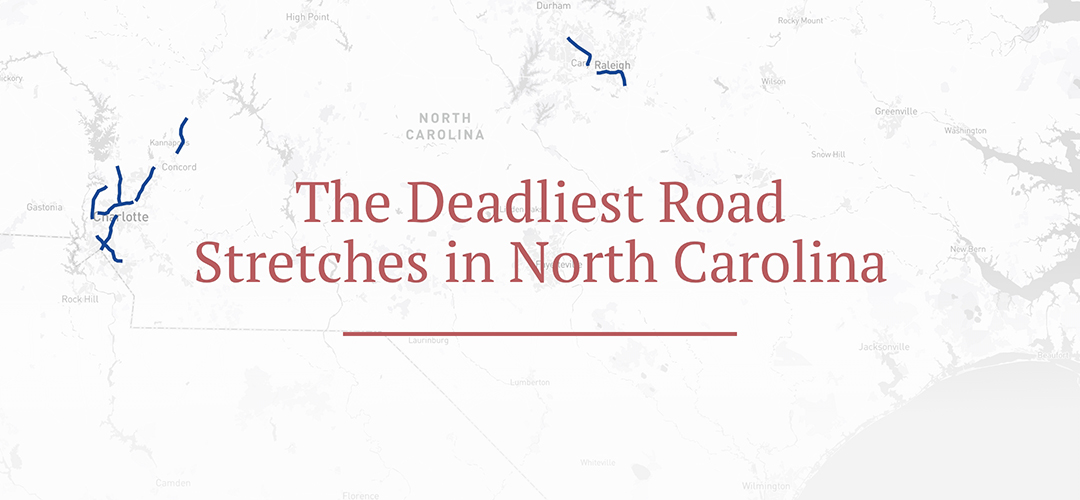
Interactive Map of North Carolina’s Deadly Road Stretches
The map below shows the 10-mile segments included in our analysis. You can zoom in to explore specific areas or use the menu to jump to a location of interest.
Methodology
To determine which stretches of highway in North Carolina experience the most fatal crashes, we used data from the Fatality Analysis Reporting System (FARS), a federal database by the National Highway Traffic Safety Administration (NHTSA) that records details on deadly traffic collisions across the country.
Our study looked at all fatal crashes in North Carolina between 2019 and 2023. We analyzed crash locations by mapping them onto the state’s highway system and examining them in 10-mile segments. Starting with the segment showing the highest number of fatalities, we identified and ranked additional segments with significant crash totals. This step-by-step process was repeated across interstates and major highways to isolate the deadliest sections based on crash concentration
Fair Use Statement
Please feel free to share or cite this analysis. We just ask that you include a link to the original report so others can review the complete data and context behind the findings.